Here you can find Historic Map Reproductions of Charleston and the surrounding areas. We print the maps using museum-grade acid-free paper, which means they will not fade or deteriorate. Since Lowcountry Sketches actually prints its own maps, they are available in various sizes to meet your spacing needs. They are available either unframed or framed. We offer using our custom made barnwood frames or we can use any universally available frame molding. We also offer vintage maps of other U.S. areas or locations using our map research services. If interested, contact allyn@lowcountrysketches.com
Made Locally in the Charleston area


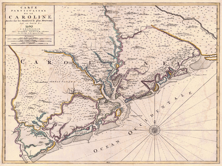
1690 Caroline (French map of Carolina)
1690 Caroline (French map of Carolina) from
$45.00

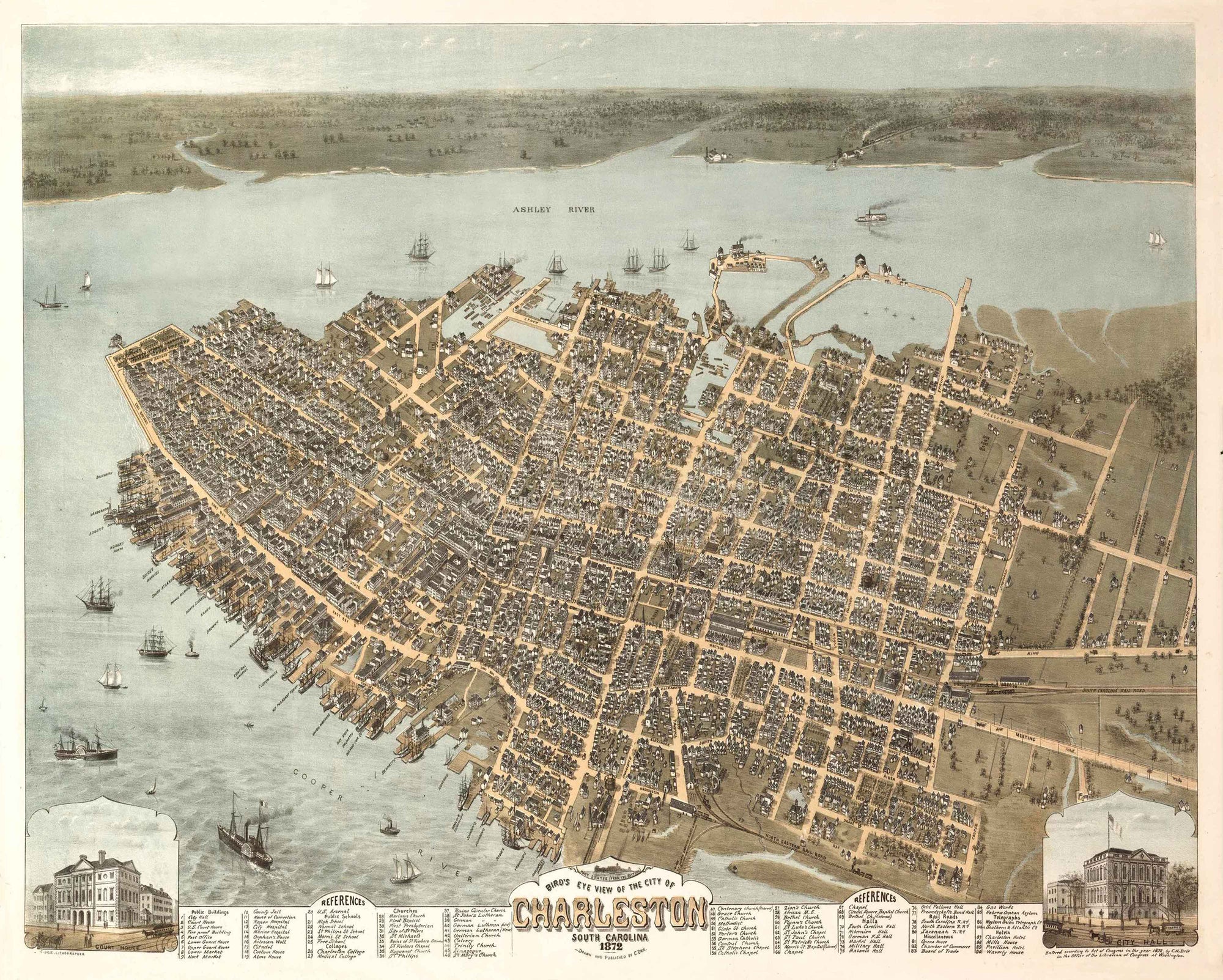
1872 Birdseye View of Charleston
1872 Birdseye View of Charleston from
$45.00

1718 Blackbeard's Blockade of Charleston
1718 Blackbeard's Blockade of Charleston from
$45.00

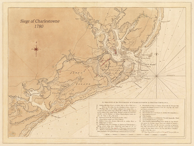
1780 Siege of Charlestown - Revolutionary War (Horizontal view)
1780 Siege of Charlestown - Revolutionary War (Horizontal view) from
$45.00

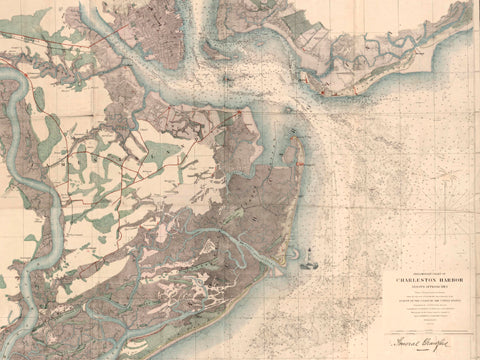
1858 General Crawford's Map w/ Morris Island Lighthouse image
1858 General Crawford's Map w/ Morris Island Lighthouse image from
$45.00

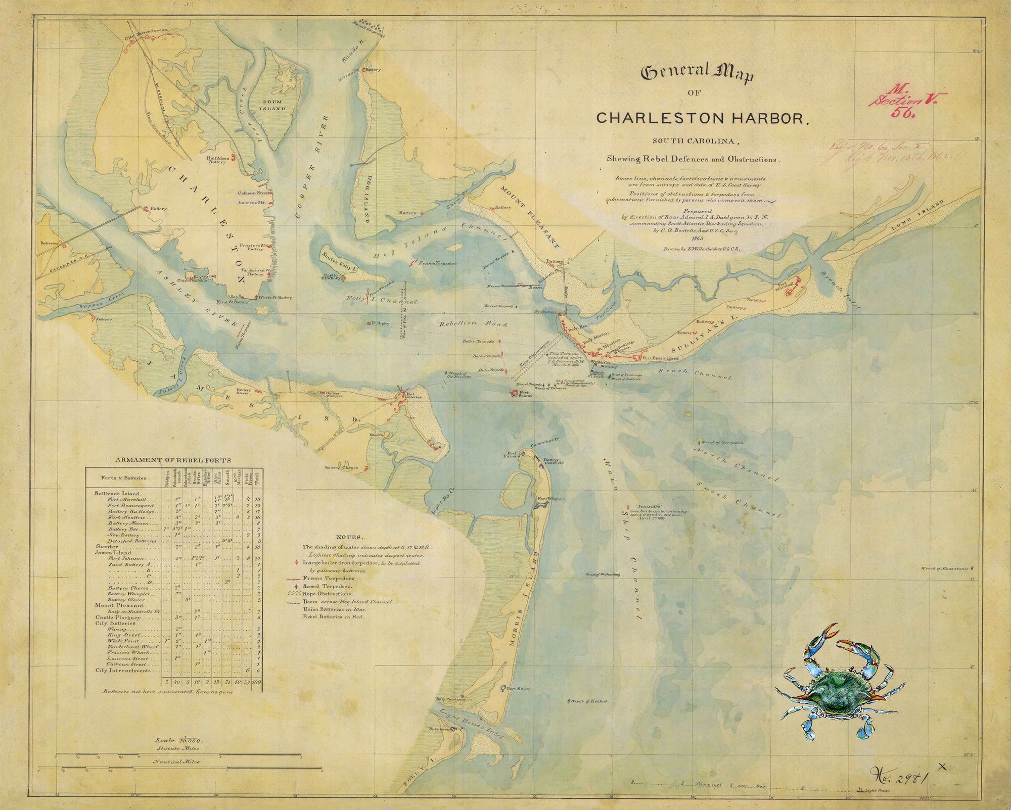
1865 General Map of Charleston Harbor (with crab artwork)
1865 General Map of Charleston Harbor (with crab artwork) from
$45.00

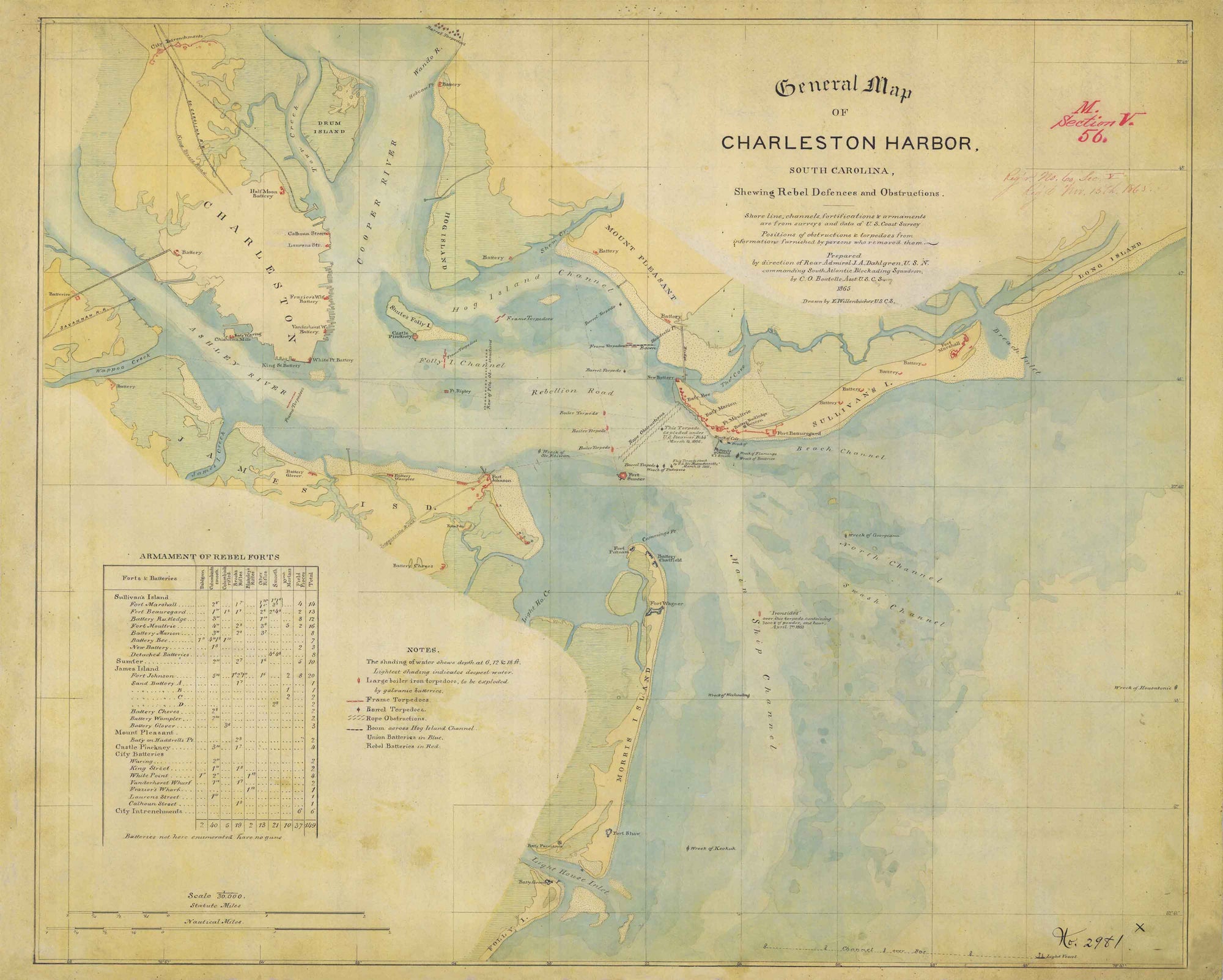
1865 General Map of Charleston Harbor
1865 General Map of Charleston Harbor from
$45.00

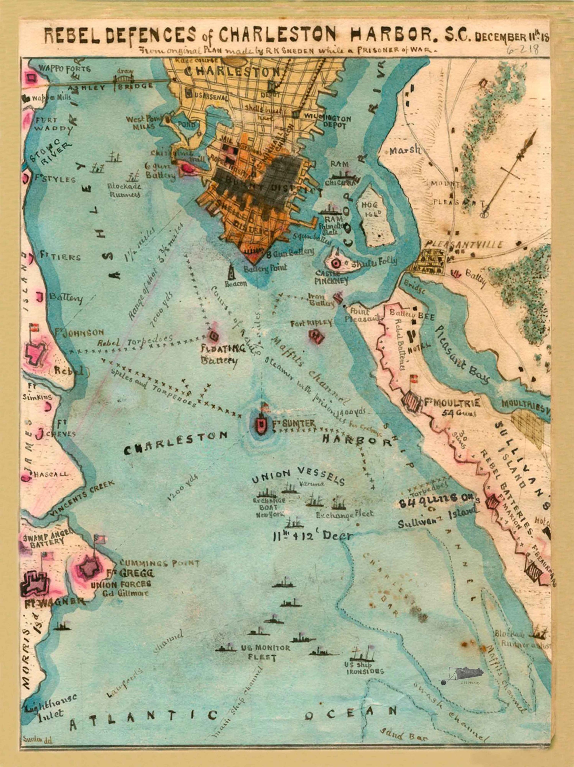
1864 Rebel Defences of Charleston Harbor, SC
1864 Rebel Defences of Charleston Harbor, SC from
$45.00

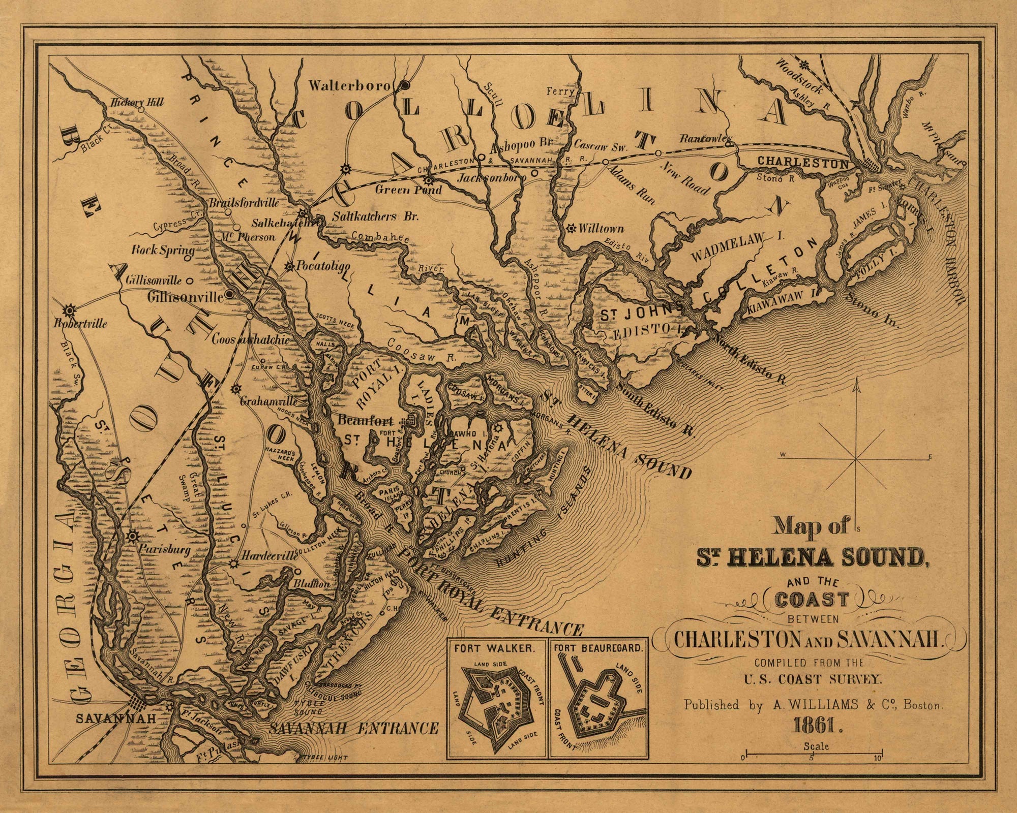
1861 St. Helena Sound and Surrounding Areas
1861 St. Helena Sound and Surrounding Areas from
$45.00

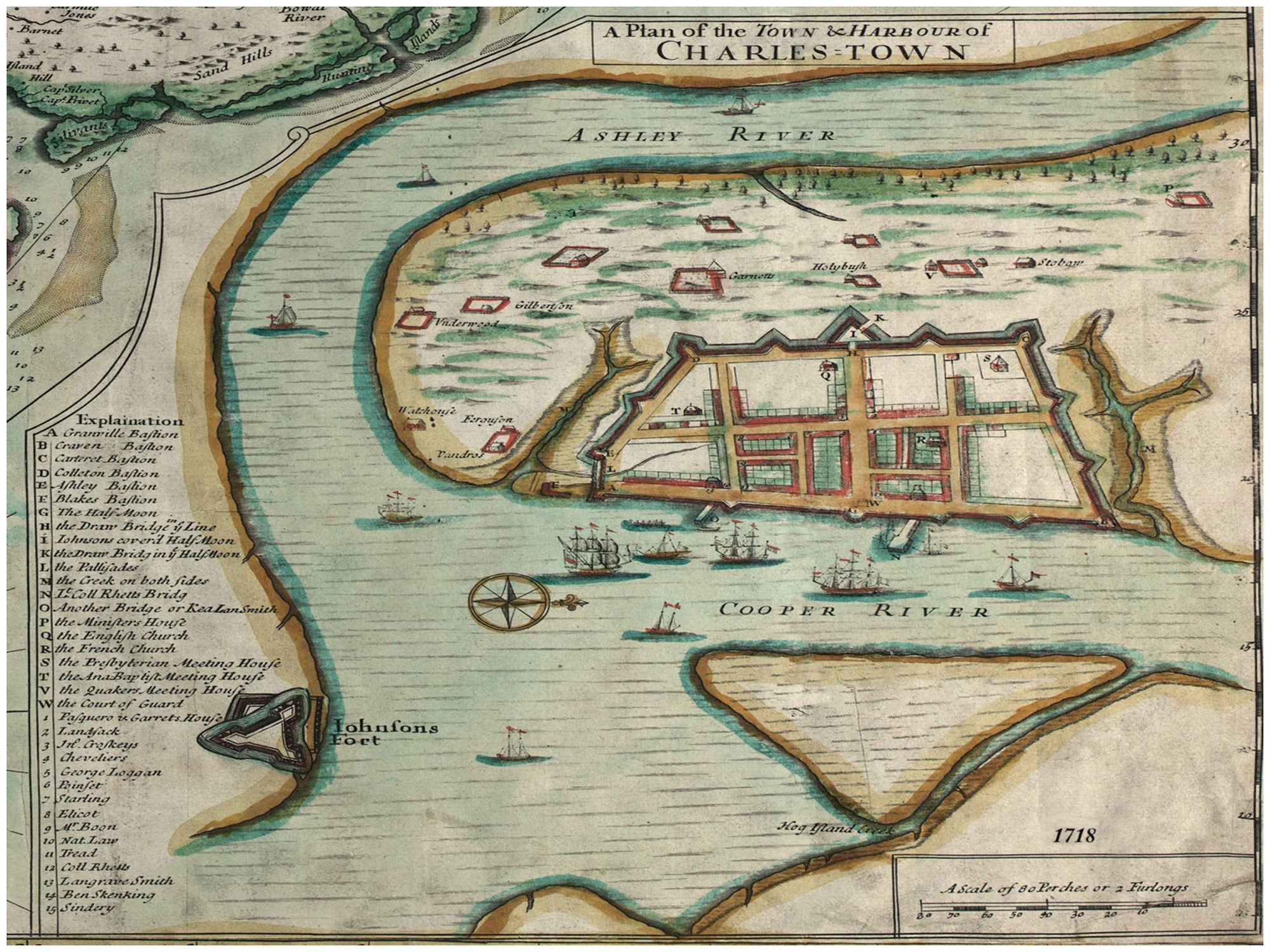
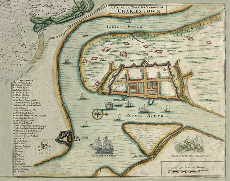
1718 The Walled City, Charles Town
1718 The Walled City, Charles Town from
$45.00