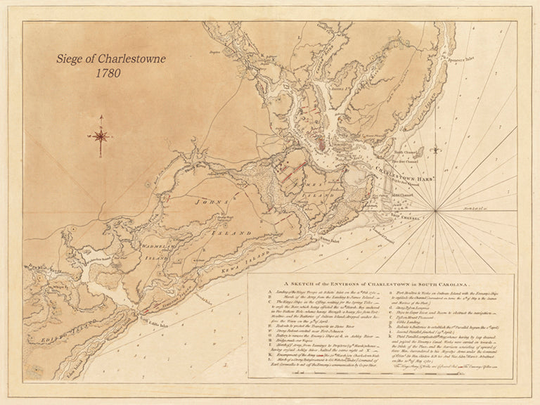
1780 Siege of Charlestown - Revolutionary War (Horizontal view)
$125.00
This 1780 map depicts Charlestowne and the surrounding area when British commander Sir Henry Clinton, along with Lord Charles Cornwallis and 14,000 British soldiers, sailors, and marines, arrived with a plan to finally capture Charlestowne. The British had captured Savannah, Georgia in 1778, and in 1780, Clinton and Cornwallis decided they would move up the coast and attack Charlestowne from the land. The British landed at Edisto Inlet and marched northeast to James Island, with the intent on moving across the Ashley River to Charlestowne Neck and take the city by land. At the time, the American Patriots in Charlestowne were in poor shape militarily.
Since its heroic defense in 1776 at what became known as Fort Moultrie, there had been little threat to the city, so most the military fortifications were in disrepair, as was Charlestowne’s military organization. The major American forces consisted of 1,600 Continentals, mostly from South Carolina and Virginia, and 2,000 militiamen from around the state, all under the command of General Benjamin Lincoln. Earlier in 1780 General Lincoln made an ill-advised decision to move his troops onto the Charlestowne peninsula between the Ashley and Cooper rivers, which proved disastrous. The British started their siege of Charlestowne on April 1, 1780. On May 12, 1780, the British took the city after Lincoln was forced to surrender the Continental Southern Army, a loss not rivaled in the US until Patton had to surrender the Philippines during World War II, according to many historians.
