1864 Rebel Defences of Charleston Harbor, SC
$125.00
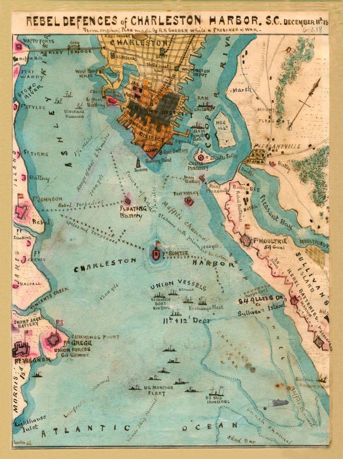
The "Rebel Defences of Charleston Harbor" map identifies several Union and Confederate forts, fortresses, and batteries. It includes such famous sites as Fort Johnson and Fort Sumter, from which the first shots of the war took place on April 12, 1861. It also identifies several other key military sites such as Fort Wagner, Castle Pinckney, Fort Marion, and Fort Moultrie. Fort Wagner was the target of the famous Union charge by the 54th Massachusetts, the most famous African American infantry unit, from Boston, Mass. The map also shows the prisoner exchange that took place in Charleston during a "lull" in the firing on the city by Union forces.
The original pen and ink sketch of this map was completed in December of 1864 by Union soldier, Robert Knox Sneden. He was born in 1832 and was an American landscape painter, as well as a mapmaker for the Union Army. He was an avid illustrator and made many ink sketches and drawing of locations and military installations he found through his experiences throughout the Civil War. After the Civil war, he painted this map with watercolors and completed most of his other maps, drawings, and sketches.