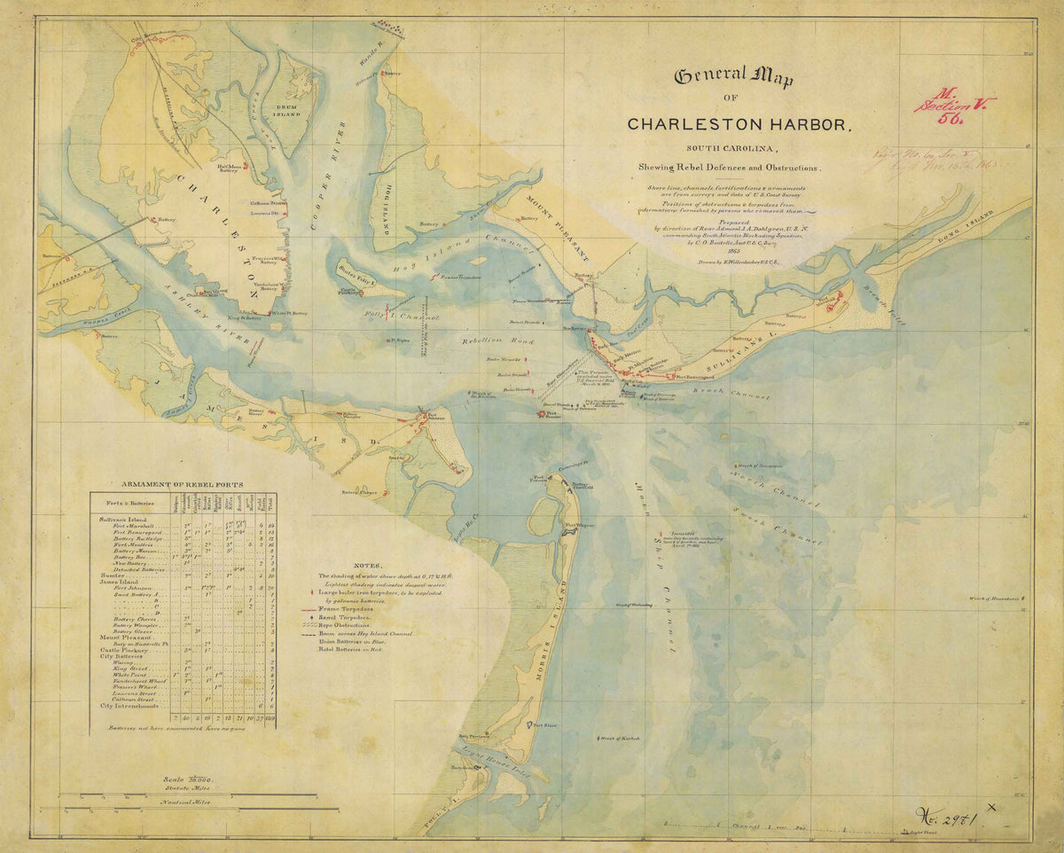
1865 General Map of Charleston Harbor
$125.00
This historic 1865 map of the Charleston Harbor shows the Rebel Defenses and various Obstructions. It is both a military map and a nautical chart depicting Charleston Harbor and its approaches including shorelines, channels, fortifications, and armaments. The map covers Charleston’s coastline from the Isle of Palms to the north to the Stono River to the south. As a military map, it shows many important military sites and events of the Civil War.