1861 St. Helena Sound and Surrounding Areas
$125.00
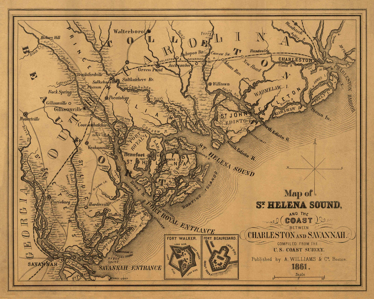
This 1861 map depicts the Port Royal area between Charleston and Savannah harbors. It shows the towns of Beaufort, Walterboro, Charleston, and Savannah as well as St. Helena, Daufuskie, Edisto, Kiawah, Wadmalaw, Folly, and Morris Islands.
The Confederate Forts Walker and Beauregard, located on either side of the Port Royal entrance are shown in the insets. This area was taken by the Union in November 1861. The white planters fled as the Union took control of the region leaving thousands of slaves. The United States controlled the area and much land between Beaufort and Charleston but were unable to take Charleston until the city was evacuated in February 1865.